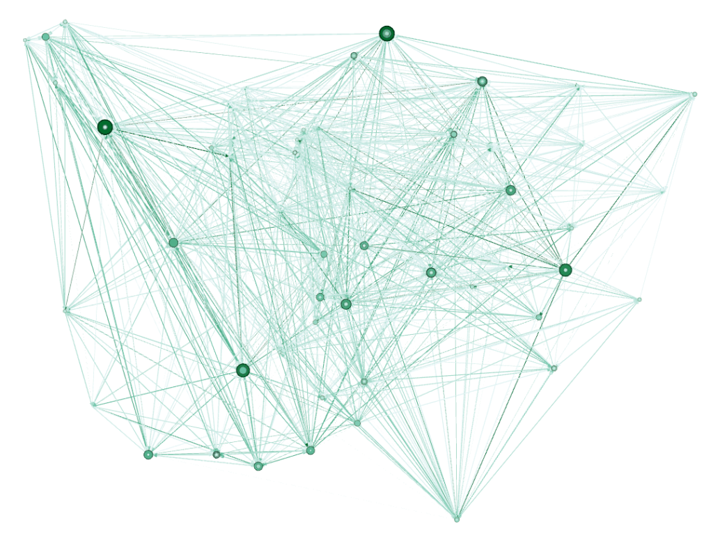
1.Using Open data
*Air port data
I am analyzing the network with public data (Node and edge csv file) and comparing it with the data I have gathered.
-Node size change according to number of degree
: This network makes it easy to find airports that serve as hubs around the world.
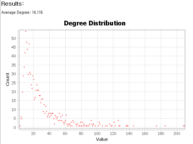
-degree distribution
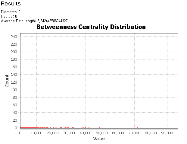
-Diameter and average path length
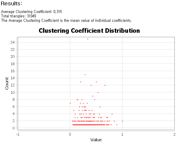
-clustering coefficient
2. Using My Data
Latitude and longitude location data is too granular to provide accurate network connectivity. So I need to unify this and analyze the criteria to see the nodes.
-Centrality
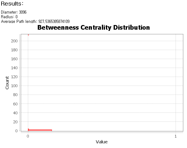
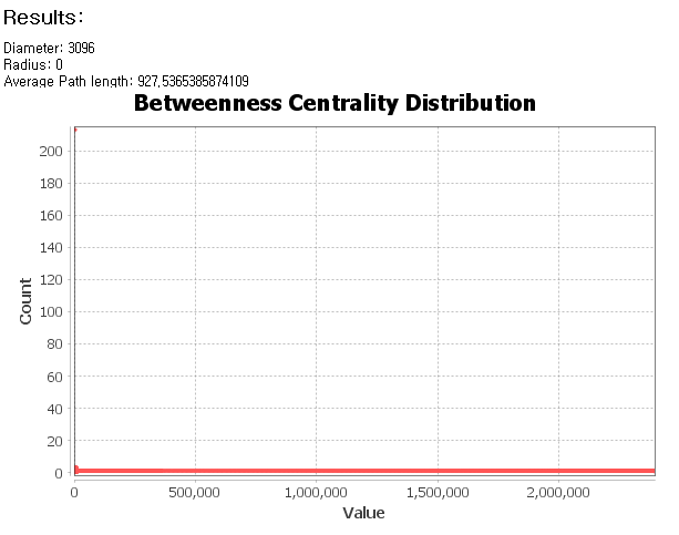
-Diameter and average path length
In the graph below, the average path length is over 900. This shows that there are very few hubs, and although visually they have a central part, they are perceived as different nodes because their values look different. There seems to be a need for correction.
*Link
