1.Network visualization
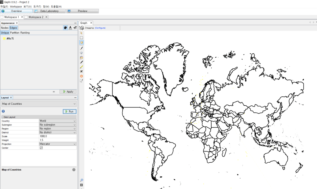
First, I challenged the visualization with one persons’s location data. I used gephi by installing two plug-ins, geolayout and map of countries.
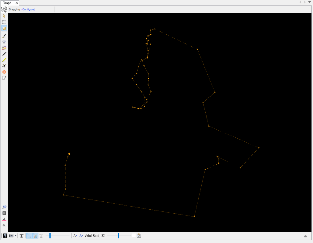
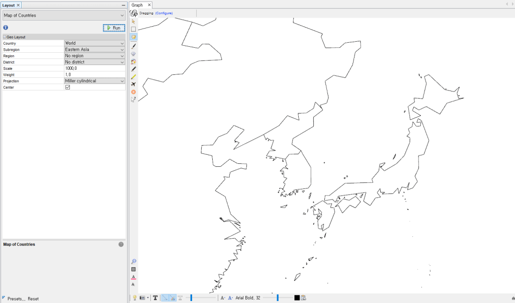
As I thought, the network was well formed with geodata via geolayout. However, the map of countries plugin is optimized for world map, so the map of Korea is not detailed. I think we should think about this again.
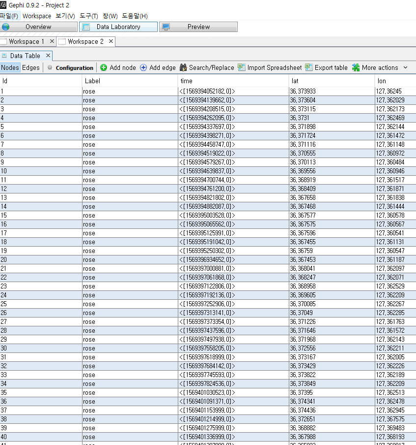
*Gephi program
-Node List
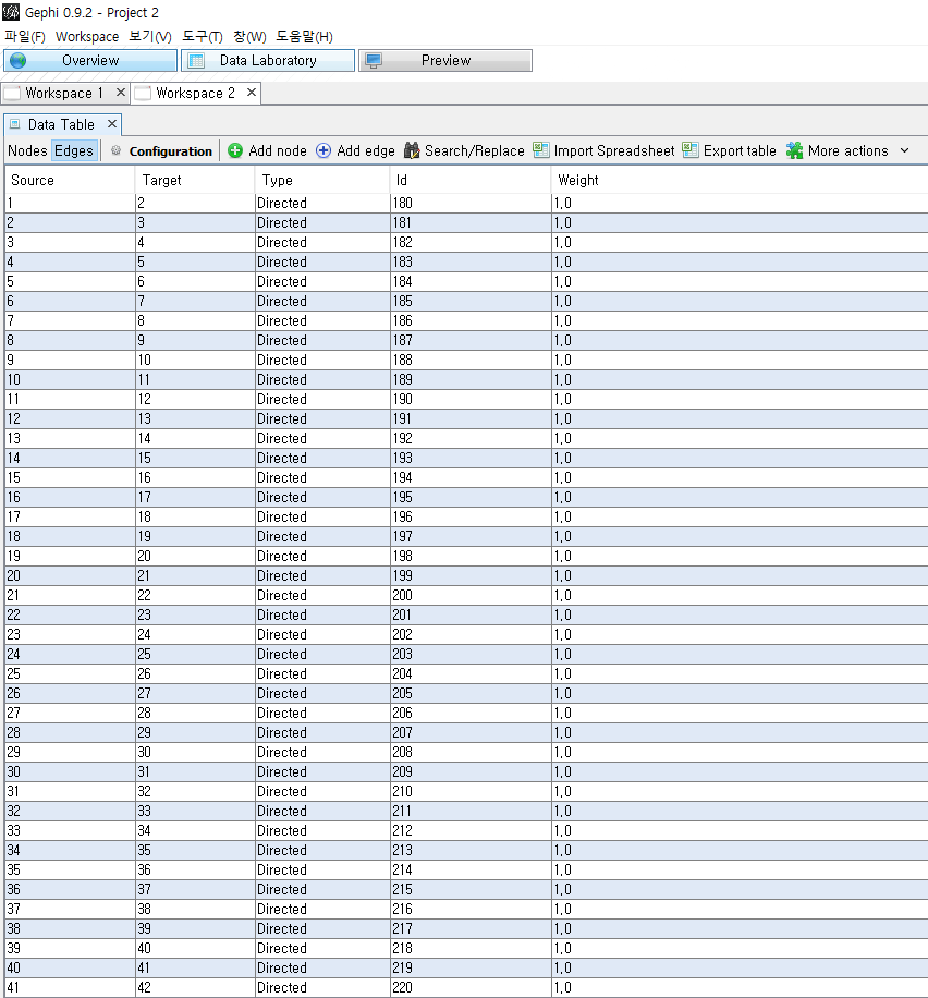
*Edge List
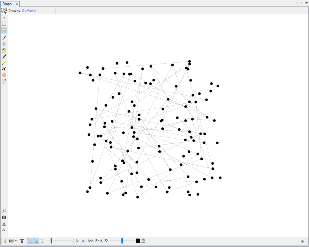
*Just connected Network
*Network according to location data (Geolayout plugin)
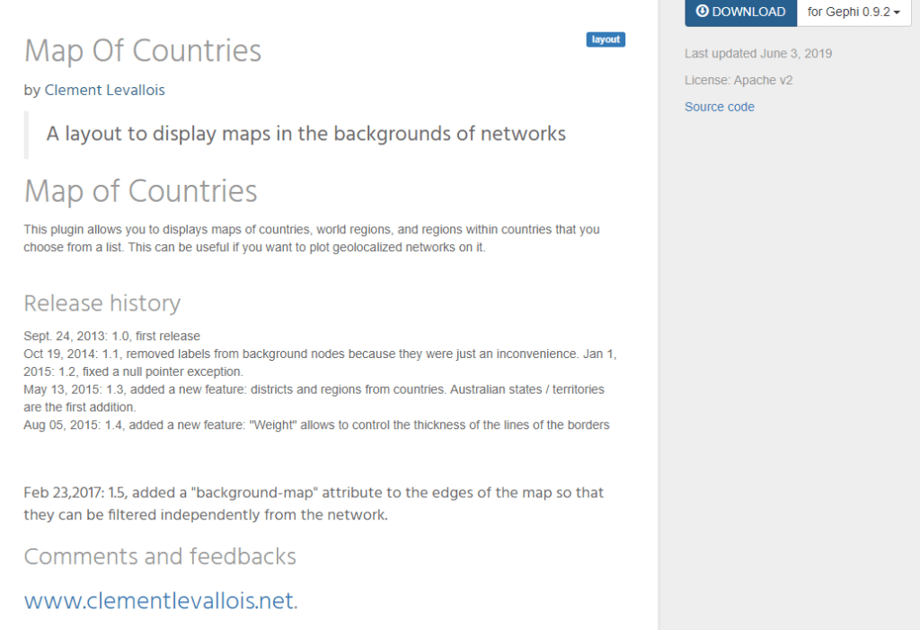
*Map of countries Plug-in
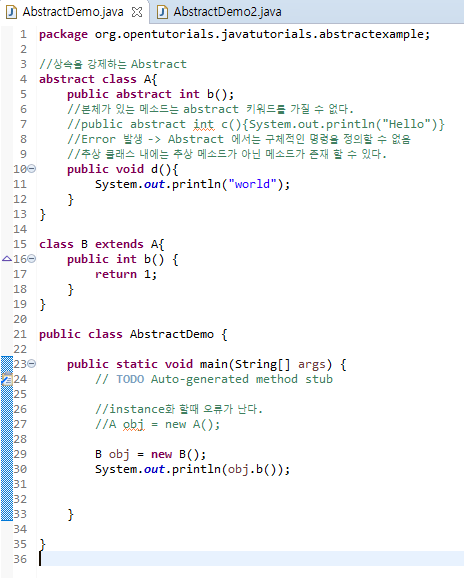
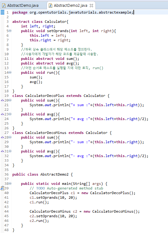
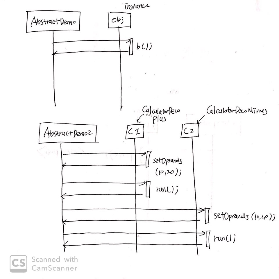
2.Java Study
Today I studied “Abstract” in Java.
*Code
*UML
*Link
