Additional information for interpreting graph
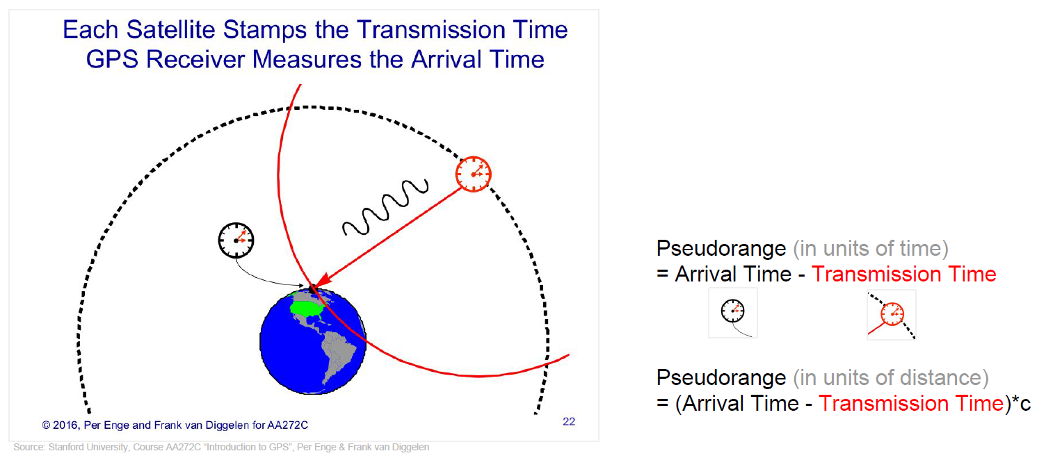
The pseudoranges of Clocks column
The pseudorange (from pseudo- and range) is the pseudo distance between a satellite and a navigation satellite receiver for instance Global Positioning System (GPS) receivers.
To determine its position, a satellite navigation receiver will determine the ranges to (at least) four satellites as well as their positions at time of transmitting. Knowing the satellites’ orbital parameters, these positions can be calculated for any point in time. The pseudoranges of each satellite are obtained by multiplying the speed of light by the time the signal has taken from the satellite to the receiver. As there are accuracy errors in the time measured, the term pseudo-ranges is used rather than ranges for such distances.
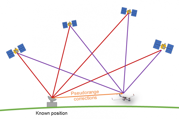
Differential GNSS
Classical GNSS technique can improve the positioning errors to meter level.
The further potential lies in the fact that GNSS signals have high spatial and temporal error characteristics for not too far (tens to hundreds kilometers) dislocated receivers. GNSS satellites work at an orbit height of about 20.000 km. Signal propagation paths from the satellite to receivers are tightly related, when the receivers are operated in distances of not more than hundreds of kilometers near Earth, i.e. strong correlations of ionospheric and tropospheric errors can be expected in many situations.